|
|


| When the Railway came to Dawlish |

As we go live on the Brunel 200 Legacy website (June 2007),
Dawlish Community Trust is completing its project of installing The Brunel
Trail, a series of interpretation boards along the coast path to celebrate ‘When
the Railway came to Dawlish’.
The Community Trust wanted to highlight the importance of the railway
to the growth and success of what had formerly been a little seaside village.
The six boards are placed along the coast path at sites of historical,
geological and social significance at:
• Coryton Cove
• Lea Mount Park (clifftop)
• Railway viaduct
• Coastguards’ footbridge
• Rockstone Flats footbridge
• Dawlish Warren footbridge
The boards are placed along the coast path
at between ten and fifteen minutes walk apart, with a slightly longer interval
to Dawlish Warren footbridge.
There is no fixed sequence for visiting the
history boards, but the content covers the town and coastline of Dawlish
in the period of change in the middle of the 19th century when railways
were developing.
At the southernmost end, in Lea Mount Park, the board shows
how Dawlish appeared in the early years of the 19th century. A sequence
of views from this location shows the gradual spread of housing onto higher
ground, giving good sea views, and the appearance of railway separating
the town from its beach.
One of the attractions of Dawlish is its setting
at the northern end of the red sandstone coast of rolling cliffs, with
their erosion into weird rock forms. This can be seen at Coryton Cove where
a board describes the geology.
At the Viaduct the board sets out the members
of Brunel’s family and his key collaborators in the development of
the South Devon Railway.
At Coastguards’ approach, the board shows
how the railway was able to overthrow the improved turnpike route into
central Dawlish and turn it to its own advantage, but to our considerable
inconvenience.
At Rockstone Flats, the board describes the ‘labour and materials’ needed
for the construction of the sea wall, and the similarity of methods to
that used in building canals in the previous century.
The northern end of
the trail is the pair of boards mounted by the old footbridge over the
railway at Dawlish Warren. From here it is possible to look up the track
to Starcross and see the old pumping station of the atmospheric railway.
The text describes that innovative – but ultimately disastrous –
enterprise, that ran for seven months under atmospheric pressure alone.
A
leaflet, a guide to the locations and content of the History Boards, was
distributed during March in time for the public ‘opening ‘ of
the Trail on Wednesday 28th March 2007 by the Mayor of Dawlish. Leaflets
are available at Tourist Information Centres and holiday park offices for
visitors to the area.
Guides who lead local walks on a regular basis will
be given copies of the material and leaflets and be introduced to the purpose
of the project. These walks are informal and anyone is invited to join
them.
It is then intended to place the material on the Dawlish Community
Trust website, and to offer links to the South Devon Coast Path website.

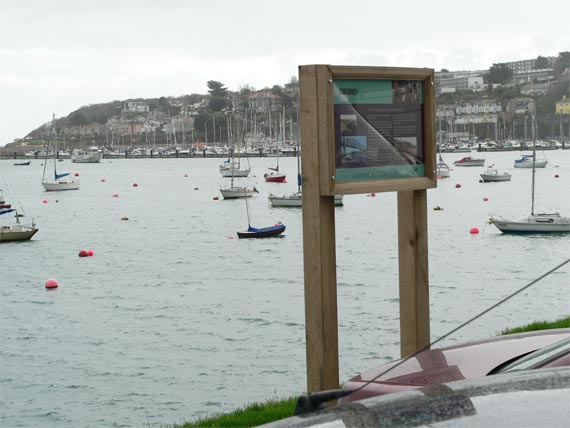
Dawlish interpretation panel in situ.
Alongside the interpretation panel installation, in 2006 the Dawlish
Community Trust supported Dawlish Museum’s
exhibition on Brunel.
The Museum’s installation on the Brunel theme
was open from 1 May.
The opening was attended by 120 people. There were 2,500 visitors during
the summer until it closed to the public for the winter cleaning period
on 30 September 2006. Educational activity takes place over the winter
months in response to requests from schools or other groups.
For further information on The
Brunel Trail, the Trail leaflet or other initiatives in the area, visit www.dawlishtomorrow.co.uk
Robert Vickery
Project Leader
|
|